-
Notifications
You must be signed in to change notification settings - Fork 20
Interpolated layer
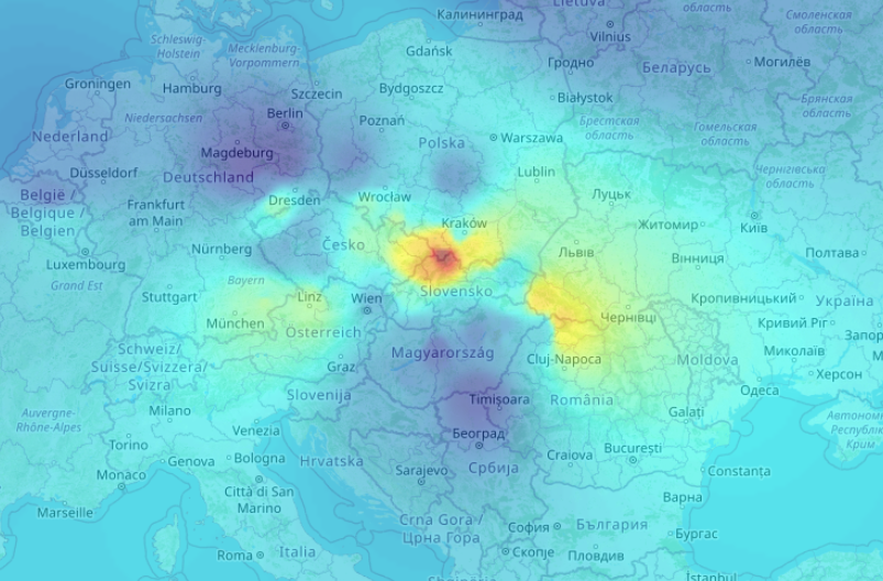
The interpolated layer is a combination of Openlayers (hereafter OL) Image as ImageLayer and OL Vector as VectorLayer that uses the HSLayers InterpolatedSource class as it's source. InterpolatedSource extends the IDW (Inverse distance weighting interpolated source - Shepard's method) class of the ol-ext library, which inherits the OL ImageCanvas class. InterpolatedSource uses the OL Vector as VectorSource class to provide the user the ability to define feature loading strategy and source loader functionality, to obtain the features. There is also an option to provide static features without using feature loader. To generate a raster image, displaying data interpolation, the user must provide value (weight), by which the image can be generated. As a result, collected features are parsed, weight values are normalized (between 0 and 100) and the image is drawn and displayed over the map. The user also has the option to change the color map. It can be a string value, name representing one of the available color maps, or a function, which handles color selection for each feature's weight value.

| Property | Type | Manditory | Default Value | Description | Example |
|---|---|---|---|---|---|
| Number | false | The largest number that can be represented in JavaScript | Maximum number of features to cache | 300 | |
| Number | false | The largest number that can be represented in JavaScript | Maximum number of features to load per extent change | 100 | |
| Array<Feature<Geometry>> | false | undefined | Static features | ||
| String | true | undefined | Feature's property that holds a number value, and will be used to calculate interpolation | 'myWeight' | |
| A callback function returning Array<Feature<Geometry>> | false | undefined | Function used to load features from external source | Example | |
| LoadingStrategy | false | undefined | A function that determines which extents are loaded and which are not | Example | |
| A string or a callback function that takes number as parameter and returns Array<Number;> | false | undefined | A function that takes normalized weight value, creates number array, representing a color, and returns it | 'jet' |
const interpolatedSource = new InterpolatedSource({
        maxFeaturesInCache: 500,
        maxFeaturesInExtent: 100,
        features: [],
        weight: () => {
          return 'fac2020';
        },
        loader: async ({extent, projection}) => {
          interpolatedSource.cancelUrlRequest.next();
          const extentIn4326 = transformExtent(extent, projection, 'EPSG:4326');
          const url = this.hsUtilsService.proxify(
            interpolatedSource.createIDWSourceUrl(
              'Place Your feature service URL here',
              extentIn4326
            ),
            app.name
          );
          try {
            const response: any = await lastValueFrom(
              this.httpClient.get(url).pipe(
                takeUntil(interpolatedSource.cancelUrlRequest),
                catchError(async (e) => {})
              )
            );
            return interpolatedSource.parseFeatures(response, projection);
          } catch (error) {}
        },
        colorMap: 'jet',
      });
      const idwLayer = new ImageLayer({
        properties: {title: 'IDW layer'},
        source: interpolatedSource as any,
        opacity: 0.5,
      });
Vector layer is mandatory, otherwise nothing will be loaded with source loader
      const idwVectorLayer = new VectorLayer({
        properties: {
          showInLayerManager: false,
          visible: idwLayer.getVisible(),
        },
        style: new Style(),
        source: interpolatedSource.getSource(),
      });
Set vector layer's visibility based on image layer, needed so that the loader is disabled once the image layer is not visible on the map.
      idwLayer.on('change:visible', (e) => {
        idwVectorLayer.setVisible(e.target.getVisible());
      });
Add both layers as HsConfig default_layers.
colorMap: (v: number) => {
//Make Your logic here and generate color
const black = [0, 0, 0, 255];
return black;
}
Quick Links: Home ➖ App configuration ➖ Layer configuration ➖ Cesium configuration ➖ Composition schema (separate repo)