You signed in with another tab or window. Reload to refresh your session.You signed out in another tab or window. Reload to refresh your session.You switched accounts on another tab or window. Reload to refresh your session.Dismiss alert
Description:
I am facing issues while using the capacitor-background-geolocation library in my Ionic application. The problem occurs frequently and manifests as follows:
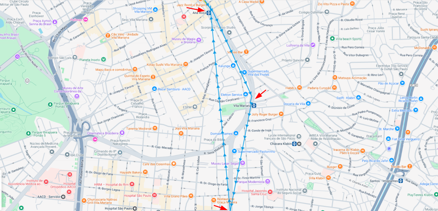
The recorded geolocation points are distant from each other, drawing straight lines on the map instead of following the actual path taken.
This behavior directly impacts the user experience and compromises the accuracy of the recorded data.
Tested Configurations:
I tried adjusting several configurations to solve the issue, but without success:
Adjustment of desiredAccuracy
Modification of distanceFilter and locationUpdateInterval
Tests with different values for stationaryRadius
Despite these changes, the points are still being recorded inconsistently.
Environment:
Capacitor Version: [6.0.1]
Plugin Version: [6.0.3]
Device OS: [Android]
Device Model: [add device model]
Ionic Framework Version: [7.2.0]
Steps to Reproduce:
Start geolocation tracking on an urban route with multiple curves.
Monitor the map in real-time or review the stored data.
Notice that the recorded points form straight lines instead of following the actual path.
Expected Behavior:
Geolocation points should be recorded accurately, following the path taken by the user.
Current Behavior:
Delays in starting location capture after the device starts moving.
Intermittent tracking, causing large distances between location points.
Suggestion:
What would be the ideal configuration to avoid this behavior? Is there any additional parameter that can help capture points more accurately in urban environments?
The text was updated successfully, but these errors were encountered:
The plug-in takes at least 200 meters of movement before the device is detected to be moving (can take longer depending on environment). This results in essentially a straight line from the last know “stationary location” to the point where the plug-in toggled into the “moving state”.
Description:
I am facing issues while using the
capacitor-background-geolocationlibrary in my Ionic application. The problem occurs frequently and manifests as follows:Tested Configurations:
I tried adjusting several configurations to solve the issue, but without success:
desiredAccuracydistanceFilterandlocationUpdateIntervalstationaryRadiusDespite these changes, the points are still being recorded inconsistently.
Environment:
Steps to Reproduce:
Expected Behavior:
Geolocation points should be recorded accurately, following the path taken by the user.
Current Behavior:
Logs and Evidence:
Configuration used:
Log:
Images

Suggestion:
What would be the ideal configuration to avoid this behavior? Is there any additional parameter that can help capture points more accurately in urban environments?
The text was updated successfully, but these errors were encountered: